

Members of the Baliwag City Advisory Group for Police Transformation and Development (C.A.G.T.P.D.) formally took their oath on Sept. 22, pledging to work alongside the local police in strengthening peace and order efforts in the city.



TS “Queenie” nears STS strength, could become typhoon by Sunday
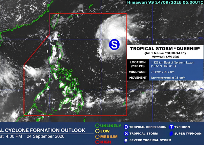
Tropical Storm “Queenie” (intl. name – Surigae) is nearing the Severe Tropical Storm category as it moves northwestward over the Philippine Sea, according to the Philippine Atmospheric, Geophysical, and Astronomical Services Administration (PAGASA).
As of 5 p.m. Thursday, Sept. 25, the tropical cyclone was located 745 kilometers east of Basco, Batanes, packing maximum sustained winds of 85 kilometers per hour (k.p.h.) with accompanying gusts of up to 105 k.p.h.
The agency reported in its track and intensity forecast that “Queenie” will become a fully-fledged typhoon outside the Philippine Area of Responsibility (P.A.R.), located 815 km Northeast of Extreme Northern Luzon, carrying maximum sustained winds of 120 k.p.h, by Sunday afternoon or evening, Sept. 27.
However, PAGASA assured that the weather disturbance is ‘unlikely to directly affect the country throughout the forecast period.’
Country to expect rainfall
In a separate weather advisory, the weather bureau anticipates cloudy skies with scattered rains and thunderstorms in Negros Island Region, Central Visayas, Zamboanga Peninsula, Northern Mindanao, Caraga, Davao Oriental, and Basilan, due to the Intertropical Convergence Zone (I.T.C.Z.) on Saturday, September 26.
PAGASA defines the weather system as “ang lugar kung saan ang hangin ng Northern Hemisphere at Southern Hemisphere ay nagtatagpo na nagdudulot ng mga sama ng panahon tulad ng mga L.P.A. (Low-Pressure Area) at bagyo.”
Meanwhile, partly cloudy to cloudy skies with isolated rainshowers or thunderstorms are expected in the rest of Visayas, the rest of Mindanao, and Palawan due to the I.T.C.Z.
Lastly, Metro Manila and the rest of the country will experience partly cloudy to cloudy skies with isolated rainshowers or thunderstorms due to localized thunderstorms.
The agency, however, warns of the possibility of flood and landslide-prone areas.